
Ecosystem Sciences has a dedicated staff of highly qualified environmental professionals. We have conducted numerous assignments pertaining to major environmental programs. We have found through this experience that most assignments require an integrated, multi-disciplinary team. Our team of professionals— with backgrounds in science, ecology, planning, GIS, cartography, and environmental design—offers a comprehensive and practiced understanding of the issues involved in environmental advisory and management services.

Projects
Big Wood River Flood Atlas– Idaho, USA
Environmental Impact Statement (EIS) / USFS / Midas Gold Stibnite – Idaho, USA
Groundwater Management Plan and Monitoring, Water Basin 37 – Idaho, USA
Upper Walla Walla River Assessment – Oregon / Washington, USA
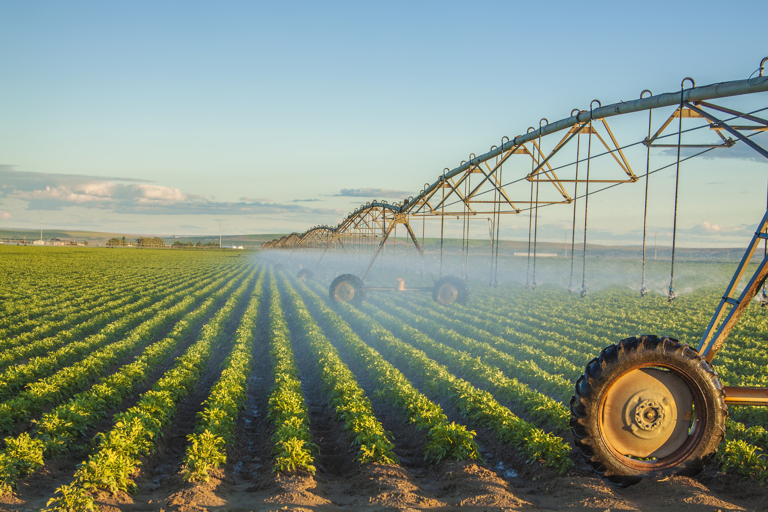
Pleasanton Watershed Stormwater Modeling and Design – Idaho, USA.
Pebble Mine Environmental Impact Statement – Alaska, USA
Wetland Assessment for Avimor Development – Idaho, USA
Idaho Department of Lands, LSR Grant (USDA, USFS); Forest Economics – Idaho USA
Urban Tree Canopy Mapping Wood River Valley – Idaho, USA
City of Boise Community Forest Management Plan– Idaho, USA
Yankee Fork/Jordan Creek OHWM Assessment – Idaho, USA
Stage 3 LEPA Surveys, Site Clearances, and NEPA Reporting, Idaho Air National Guard – Idaho, USA
City of Boise Open Space Plan – Idaho, USA
Griener’s Hope Development Wetland Assessment – Idaho, USA
Broken Horn Development Natural Features Assessment – Idaho, USA
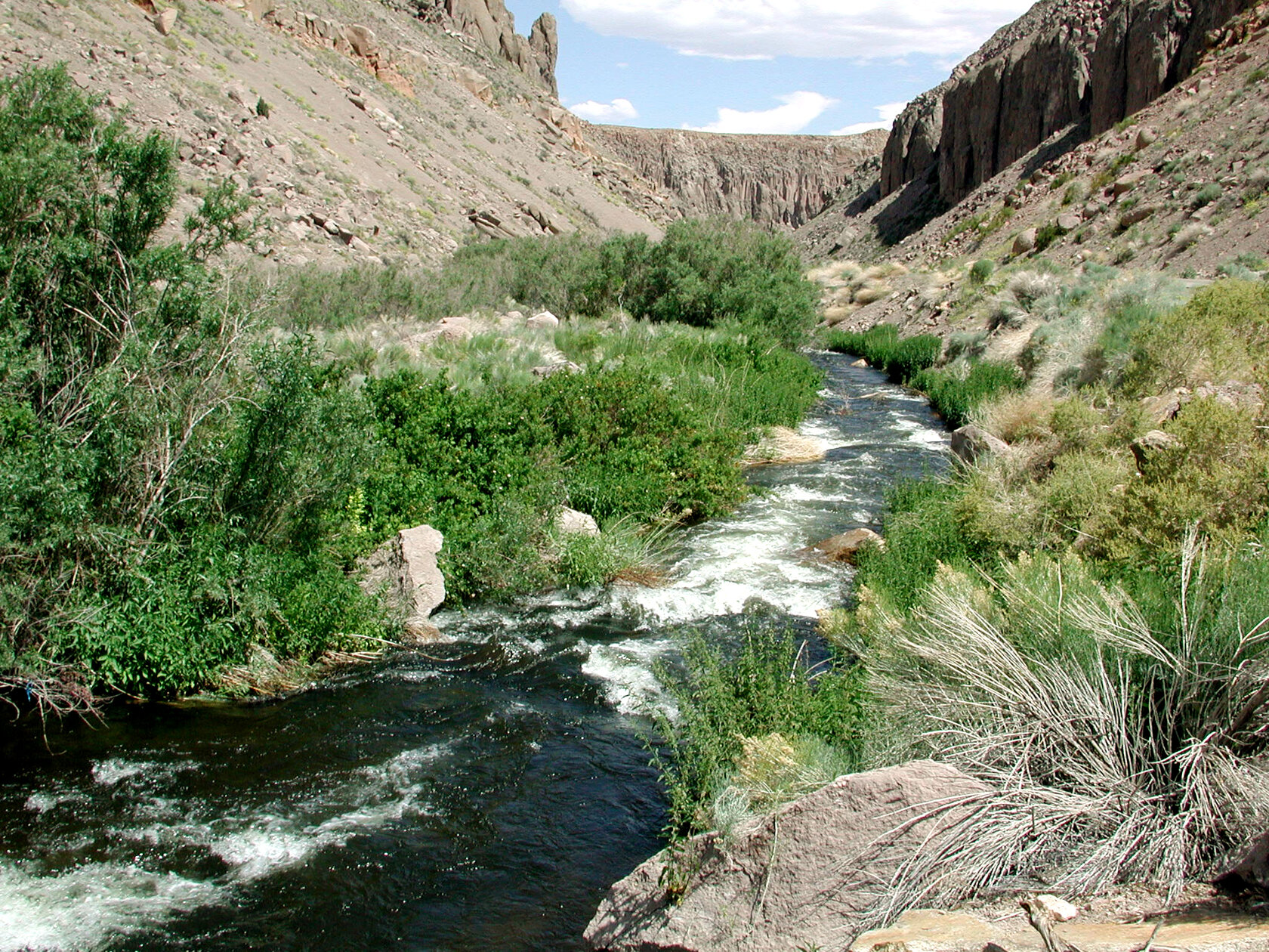
Silver Creek Geomorphic Assessment/Stream Restoration Design and Planning – Idaho, USA
United Way City of Caldwell Bike and Pedestrian Analysis and Mapping – Idaho, USA
City of Boise Health and Housing Analysis and Mapping – Idaho, USA
National Park Service Weather Buoy Station Configuration and Installation – Lake Mead National Recreation Area, USA
Data Collection and Production of Categorical Exclusions for Bogus Basin Trails/Snow Making Expansion Development – Idaho, USA
South Valley Groundwater District - Management Plan and Monitoring – Idaho, USA
Silver Spring Ranch Plan and Monitoring Program – Idaho, USA
Urban Tree Canopy / GIS Network Boise River Valley – Idaho, USA
Silver Creek Watershed Enhancement and Restoration Program – Idaho, USA
Image Geo-referencing for Land-use Litigation – North Dakota, USA
Cultural Resource Assessment Mapping – Idaho, USA
Forensic GIS and Remote Imagery Analysis – Idaho, USA
Owyhee High school Development Wetland and Cultural Resources Assessment – Idaho, USA
Imagery Acquisition and Geo-referencing for Floodplain Mapping – Idaho, USA
Trader Road Water Rights Application – Idaho, USA
Barber Pools Land Cover Classification – Idaho, USA
Tic-Toc Creek Ranch Water Rights Assessment and Mapping – Idaho, US
Park Place Development Boise River System Application – Idaho, USA
Mapping/Data Visualization for Sharaan Reserve – Kingdom of Saudi Arabia.
Pebble Environmental Impact Statement – Alaska, USA
Assessment of Wildlife Movement in Relation to Agriculture / NRCS – USA
Spring Creek Restoration Assessment and Planning – Idaho, USA
Silver Creek Cross Section and Sediment Inventory – Idaho, USA
Cottonwood Creek Daylighting Visualization – Idaho, USA
Wetland Assessment for Main Canal 6 Hydroelectric Project – Idaho, USA
Wetland Assessment and Tree Inventory for Riverpointe Development – Idaho, USA
Wetland Assessment and Cultural Resources Assessment for Villa Sport Development – Idaho, USA
Wetland Assessment and Tree Inventory for Rosewood Development – Idaho, USA
Loving Creek Stream Sediment Cross-sections – Idaho, USA
Urban Tree Canopy Planning and Analysis – Idaho, USA
Ordinary High-Water Mark and Mapping for Property on the Big Wood River– Idaho, USA
Third Party Auditing for Idaho Power Projects / Stream and Riparian Mitigation and Enhancement – Idaho/Oregon, USA
Wetland Assessment and Mitigation Planning for Williamson River Ranch Phase I, II, and III Development– Idaho, USA
Wetland Assessment and Tree Inventory for BellAir Development (Highway 44 and Linder Road) – Idaho, USA
Land Use Monitoring for BLM AIM – Montana, USA
Loving Spring Ranch Planning and Consulting – Idaho, USA
Hewlett Packard SITES Landscape Performance Monitoring – Idaho, USA
Fort Hall Habitat Restoration Project / Report to ISRP– Idaho, USA
Rock Creek Heat Source Model – Oregon, USA
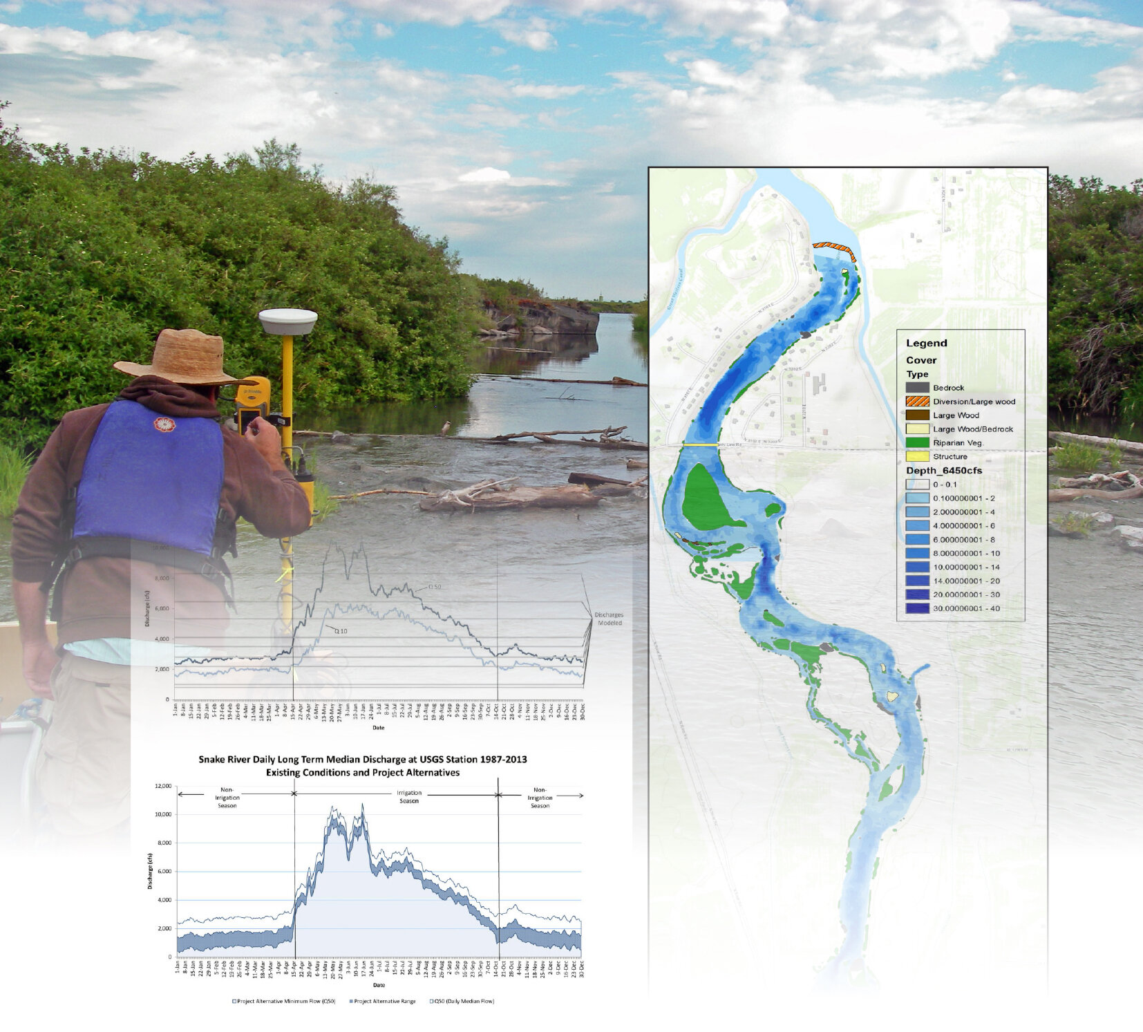
Snake River Hydrologic and Geomorphic Assessment and Environmental Studies for the County Line Hydroelectric Projects– Idaho, USA
Boise City Hall Plaza Sculpture Design – Idaho, USA
Biological Assessment and Evaluation of the Effects of the Sun Valley Resort Cold Springs Replacement and
Watershed Resources Technical Report for the Sun Valley Resort Cold Springs Replacement and Associated Projects– Idaho, USA
Vegetation Technical Report for the Sun Valley Resort Cold Springs Replacement and Associated Projects– Idaho, USA
Wildlife Technical Report for the Sun Valley Resort Cold Springs Replacement and Associated Projects– Idaho, USA
Wetland Assessment for Retail West Development – Idaho, USA
Wetland Assessment for the Mustang Crossing Development (State Street and Park Lane) – Idaho, USA
Wetland Assessment for Creighton Woods Development – Idaho, USA
Heart Rock Ranch Ordinary High-Water Mark and Habitat Mapping – Idaho, USA
Treasure Valley Forest Carbon Assessment, USA
Loving Creek Ranch Pond Cross Section for Permitting – Idaho, USA
Wetland Assessment for the Albertsons, Meridian Project – Idaho, USA
Little Missouri Grasslands Mapping – North Dakota, USA
Rio Brava Ranch Mapping, Database Design and Cartography – Idaho, USA
Data Collection for Bathymetric Model of Yellowtail Afterbay Dam – Montana, USA
Buckeye Farms Water Monitoring Plan – Idaho, USA
Kuwait National Environmental Atlas/ eMisk – Kuwait
South Platte Natural Capital Project – Colorado, USA
Harris Ranch Stormwater Reuse and Irrigation – Idaho, USA
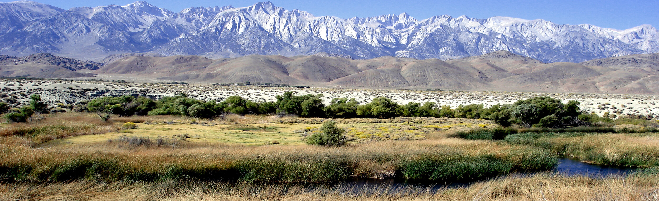
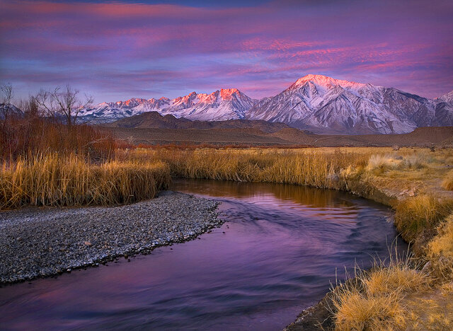
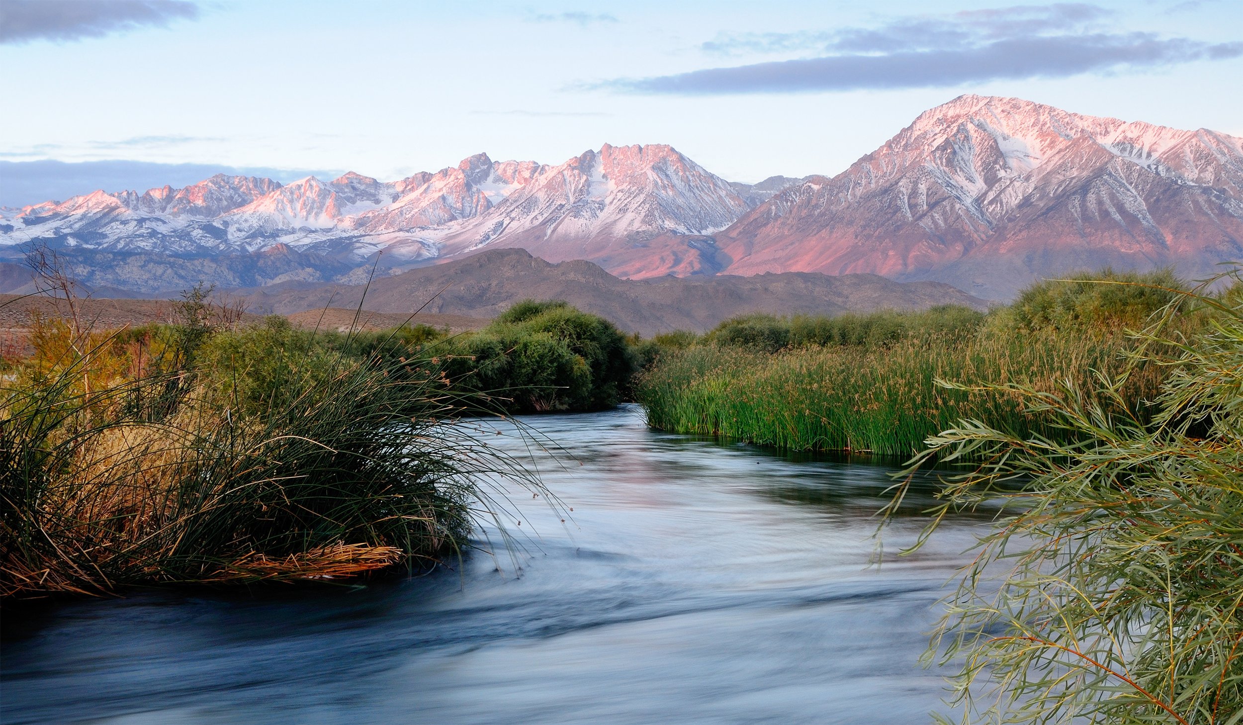
Lower Owens River Restoration Project - California, USA
MSA for Stormwater Infrastructure – California, USA
Idaho Air National Guard Natural Resources Baseline Inventory/Rare Plant Survey - Idaho, USA
Idaho Air National Guard Migratory Bird Counts/Bird Inventory – Idaho, USA
Bogus Basin Development Project Natural Features Assessment – Idaho, USA
Cottonwood Meadows Wetland Assessment – Idaho, USA
Eagle Lakes Apartments ESA Compliance Letter – Idaho, USA
Isla del Rio Environmental Assessment and Consultation – Idaho, USA
Birch Creek Geomorphic Assessment and Action Plan – Oregon, USA.
ACHD Subwatershed and Stormwater Planning – Idaho, USA
Environmental Impact Assessment, Stillwater Subdivision – Idaho, USA
Copper Basin Grazing Assessment– Idaho, USA
Great American Landscape Plan / ESRI – California, USA
Green Infrastructure Planning and National Map / ESRI – California, USA
Cat Creek Land Cover Mapping – Idaho, USA
Diggie Creek Environmental Permitting – Idaho, USA
Source Water Protection Interpretive Display / Meridian – Idaho, USA
City of Boise Community Forestry Plan – Idaho, USA
Bear River Hydroelectric Project (FERC #12486) Consulting – Idaho, USA
Treasure Valley Urban Tree Canopy GIS Analysis and Education – Idaho, USA
Mountain Meadows Botanical Survey – California, USA
Riverine-Riparian PFC Assessment of Streams / BLM – Montana, USA
Boise River Enhancement Plan / Boise River Enhancement Network – Idaho, USA
John Day River Watershed Atlas and Restoration Strategy – Oregon, USA
Watershed Enhancement Strategy / Snake River– Idaho, USA
Dry Creek Restoration Planning – Idaho, USA
Fort Hall Bottoms LiDAR, GeoDatabase, Vegetation Assessment – Idaho, USA
Starkey Hot Springs Ecological Site Planning – Idaho, USA
Lower Nehalem Watershed Atlas / Cartography – Oregon, USA
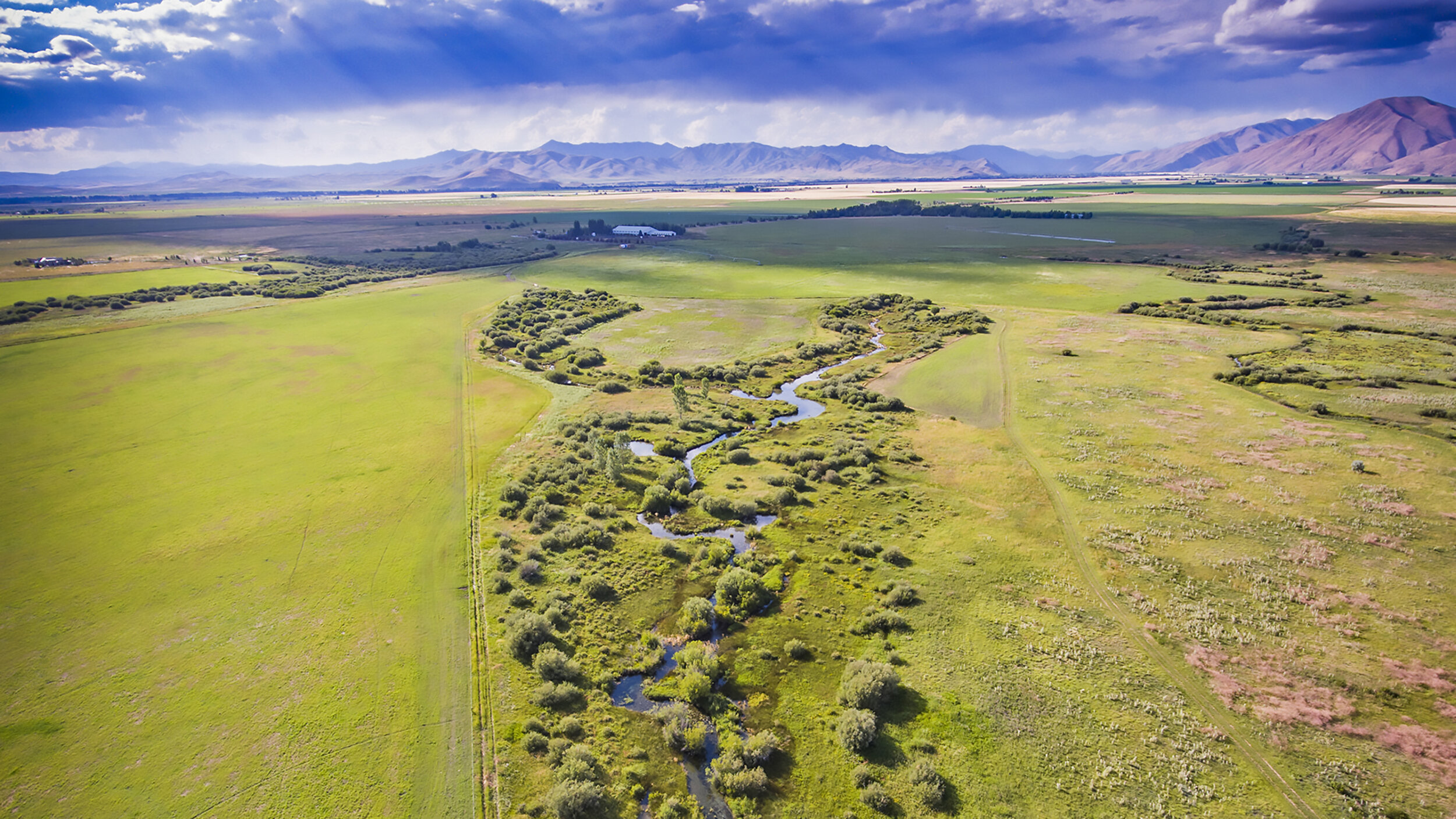
Big Wood River Assessment of Hydropower and Irrigation – Idaho, USA
Bear River Hydroelectric Project (FERC #12486) Conceptual Mitigation Plan – Idaho, USA
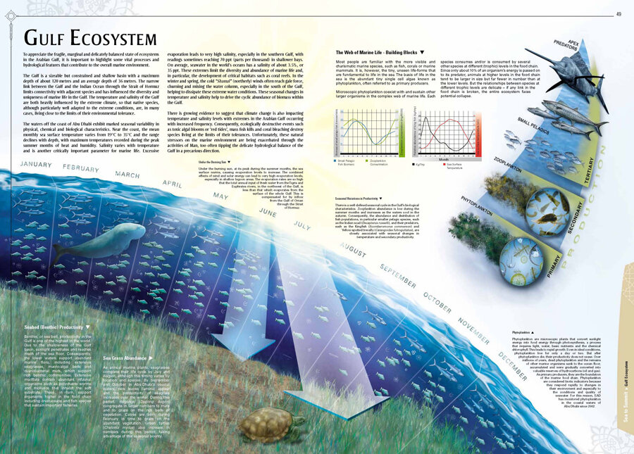
Environmental Reporting / Marine Water Quality – Abu Dhabi, United Arab Emirates
Environmental Reporting / Air Quality – Abu Dhabi, United Arab Emirates
Perkins Nature Area Conservation Plan – Idaho, USA
GeoVillage / GeoDatabase Design – San Miguel de Allende, Mexico
Lower Owens River Project / Hydraulic Modeling – California, USA
Bear River Hydroelectric Project (FERC #12486) Wetland Delineation and Functional Assessment – Idaho, USA
Merced River Fish Passage Assessment and Design – California, USA
Warmsprings Dam Hydroelectric Project (FERC #13570) – Oregon, USA
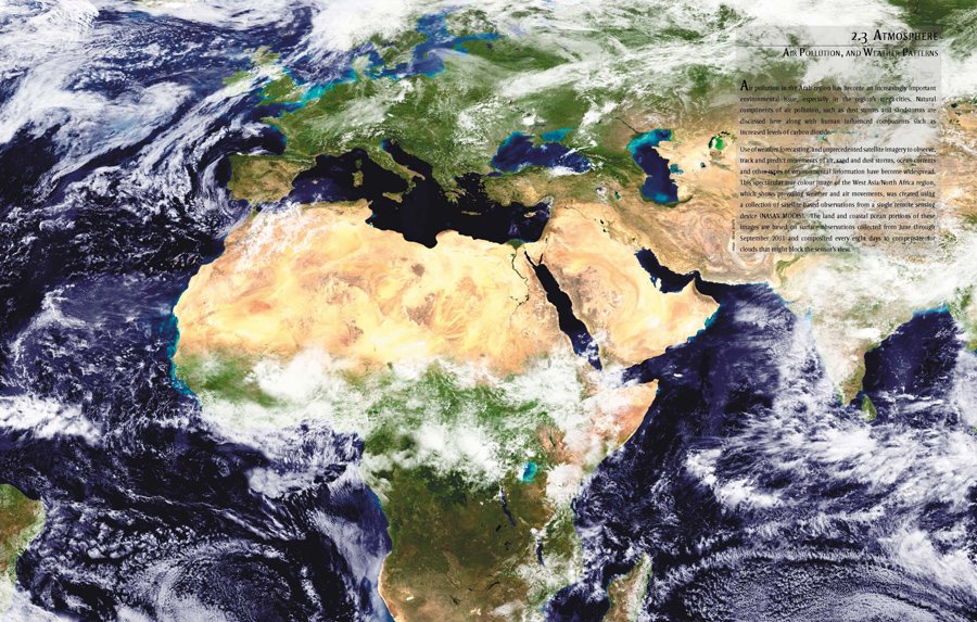
Atlas of Environmental Change / UNEP - West Asia and North Africa
Habitat Conservation Plan / Inyo and Mono Counties – California, USA
Bear River Hydroelectric Project (FERC #12486) Conceptual Wetland Mitigation Plan – Idaho, USA
Kilpatrick Pond Restoration – Visual Design Assessments – Idaho, USA
Linehan Flat Botanical and Wildlife Clearances – Idaho, USA
Silver Creek Restoration and Enhancement Plan - Idaho, USA
Newmont Mining Environmental Consulting – Colorado, USA
Todos Por El Agua / Payment for Watershed Services Program – Rio Laja, Mexico
Big Wood River Flow Study and Recommendation – Idaho, USA
National Environmental Atlas - Abu Dhabi, United Arab Emirates
Gibson Dam Hydro Project Special Status Plant / Noxious Weed Survey – Montana, USA
Bear River Hydroelectric Project (FERC #12486) Land Cover Study Report – Idaho, USA
Bear River Hydroelectric Project (FERC #12486) Visual Resources Study – Idaho, USA
Bear River Hydroelectric Project (FERC #12486) Bald Eagle and Peregrine Falcon Use and Habitat Assessment – Idaho, USA
Bear River Hydroelectric Project (FERC #12486) Rock Squirrel Population and Habitat Use Assessment – Idaho, USA
Bear River Hydroelectric Project (FERC #12486) Amphibian and Reptiles Study – Idaho, USA
Bear River Hydroelectric Project (FERC #12486) Trumpeter Swan Use and Habitat Assessment – Idaho, USA
Bear River Hydroelectric Project (FERC #12486) Wild Turkey Habitat Use and Assessment – Idaho, USA
Bear River Hydroelectric Project (FERC #12486) Big Game Habitat and Migration Assessment – Idaho, USA
Bear River Hydroelectric Project (FERC #12486) Bat Populations Use and Habitat Assessment – Idaho, USA
Bear River Hydroelectric Project (FERC #12486) Waterfowl / Waterbird Study Report – Idaho, USA
Bear River Hydroelectric Project (FERC #12486) Resident and Migratory Landbird Report – Idaho, USA
Bear River Hydroelectric Project (FERC #12486) Special Status Plant and Noxious Weed Survey Report – Idaho, USA
Riparian Habitat and Grazing Management – California, USA
Owens Valley Land Management Plan – California, USA
Inyo-Mono Integrated Regional Watershed Management Grant Proposal – California, USA
Wetland Delineation Report / South Five Mile Road – Idaho, USA
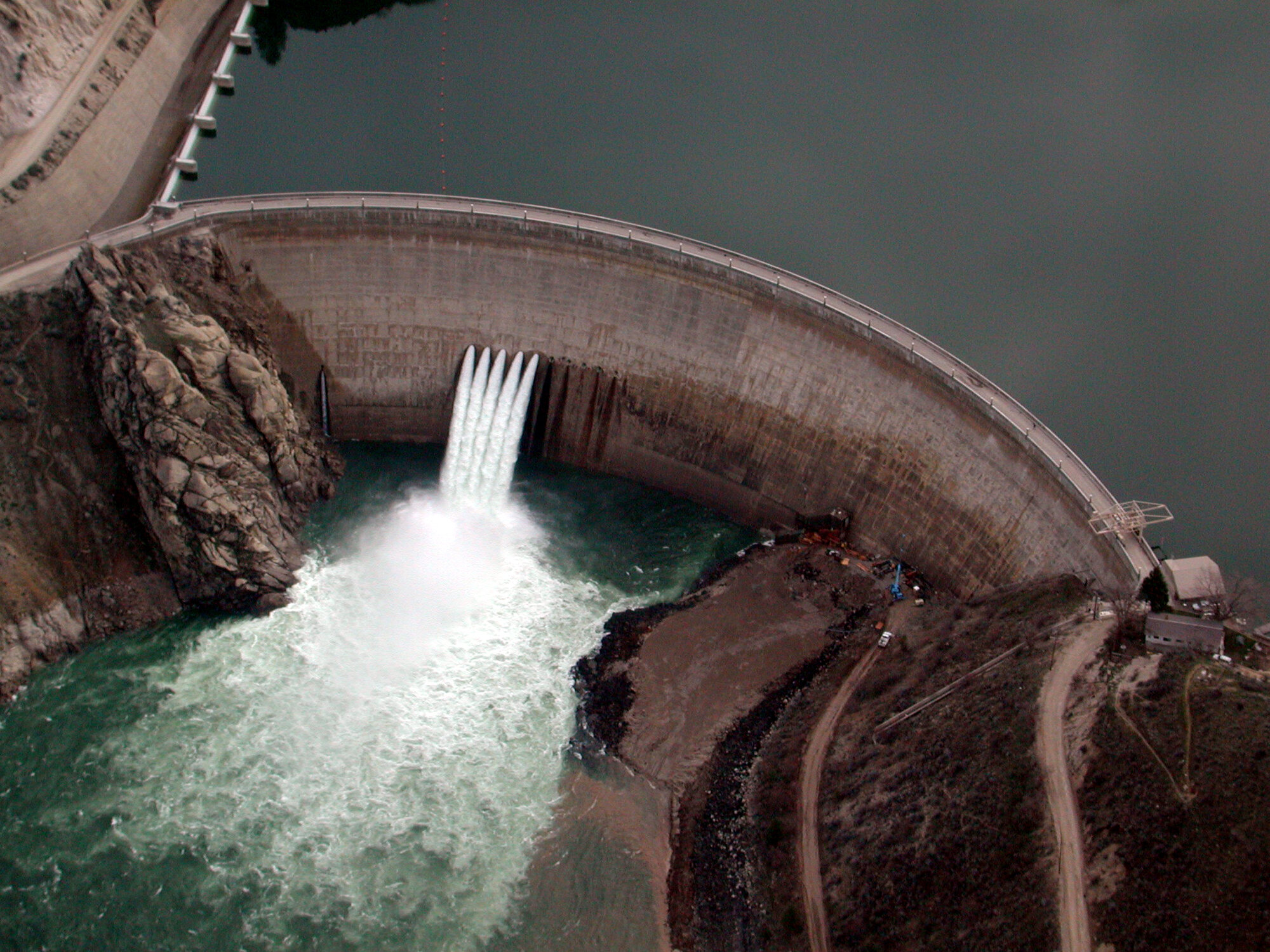
Arrowrock Dam Photo Simulations and Modeling FERC Licensing – Idaho, USA
Wilson Properties Natural Features Analysis and Biological Assessment – Idaho, USA
Baxter Ranch Water Power Station Biological Resources Report – Idaho, USA
Urban Ecology and Planning / UNESCO World Heritage City - San Miguel de Allende, Mexico
Water Rights Permitting / Multiple Vineyards and Farms – California, USA
Instream Flow Study of the South Fork of the Pit River – California, USA
Big Lost River Mountain Whitefish Status Report – Idaho, USA
Pit Resource Conservation District Watershed Management Strategy – California, USA
Integrated Regional Watershed Management Planning - Cosumnes, American, Bear and Yuba (CABY) River Watersheds – California, USA
Well Groundwater Quality Assessments – San Miguel de Allende, Mexico
Middle Owens River Flow Study and Instream Flow Recommendations – California, USA
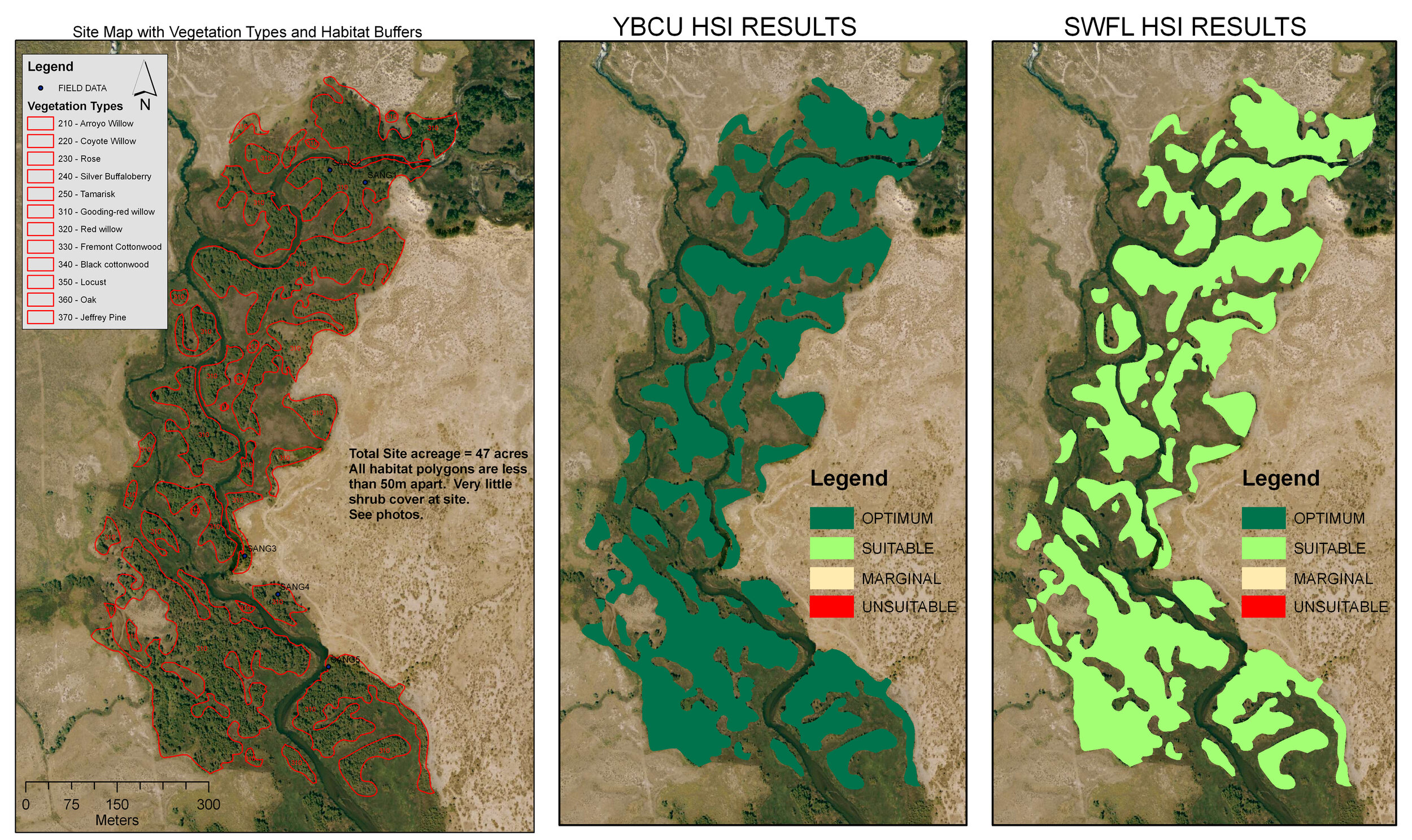
Yellow-billed Cuckoo Habitat Conservation and Planning – California, USA
Tieton River (FERC #3701) Sensitive Plant Survey – Washington, USA
Feather River Watershed Management Strategy; Feather River Integrated Regional Watershed Management Plan – California, USA
Urban Ecological Planning; Design Manual for Lower Boise River - Idaho, USA
Arroyo Pasajero Watershed Ecosystem Management Plan – California, USA
Rio Laja/Lerma Watershed Ecology and Sustainability Plan – Guanajuato State, Mexico
Boundary Hydroelectric Project – Washington, USA
Weiser East Fork Ditch Hydropower Project – Idaho, USA
Management of Aquatic Ecosystems through Community Husbandry (MACH) Project – Philippines
Global Environmental Facility Subprogram for the Mekong Basin – Laos, Thailand, Cambodia, Vietnam
Cedar River Habitat Conservation Plan – Washington, USA
Mekong River Watershed Ecology and Fishery Study – Laos, Thailand, Cambodia, Vietnam
Owens River Gorge Restoration and Fisheries Management – California, USA
Middle Snake River Ecological Study – Idaho, USA
Jamuna Bridge Special Fisheries Mission – Bangladesh
Review and Evaluation of the Coastal Resource Management Project (CRMP) – Philippines
EGIS design for research on floodplain fisheries habitat – Bangladesh
Megna Estuary Study Assessment – Bangladesh
ISPAN Flood Action Plan – Bangladesh
ISPAN Bangladesh Environmental Impact Assessment – Bangladesh
Mekong River Ecological Assessment – Laos, Thailand, Cambodia, Vietnam
Nile River Water Quality and Ecology Project – Egypt
Clients
United States Forest Service
National Park Service
US Environmental Protection Agency
US Fish and Wildlife Service
Idaho Department of Water Resources
Bureau of Land Management
The Nature Conservancy
Idaho Department of Environmental Quality
South Valley Groundwater District, ID
Galena Groundwater District, ID
US Army Corps of Engineers
California Water Commissioners
California State Water Resource Control Board
California Department of Fish and Game
Idaho Department of Fish and Game
Shoshone-Bannock Tribes
Confederated Tribes of the Umatilla Indian Reservation
ESRI, Inc
United Nations Environmental Programme
Idaho Army National Guard
Ada County Highway District, ID
Idaho Power, ID
Los Angeles Department of Water and Power, CA
Bonneville Power Administration
Seattle City Light, WA
El Dorado Irrigation District, CA
Nevada Irrigation District, CA
Placer County Water Agency, CA
El Dorado County Water Agency, CA
The Land Group, ID
Blaine County, ID
Twin Lakes Canal Company, ID
CHSQA Architect and Engineers, ID
Barker Rosholt & Simpson LLP, ID
Givens Pursley LLP, ID
Pinnacle Land Development, LLC
Mountain Waterworks, Inc, ID
U.S. Agency for International Development
World Bank
Asian Development Bank
Danida and the Netherlands Government
San Miguel de Allende Municipal Government, MX
Environment Agency Abu Dhabi
Abu Dhabi Global Data Initiative (AGEDI)
Urban Planning Commission Abu Dhabi
Geographic Planning Collaborative, International